Park of the Week
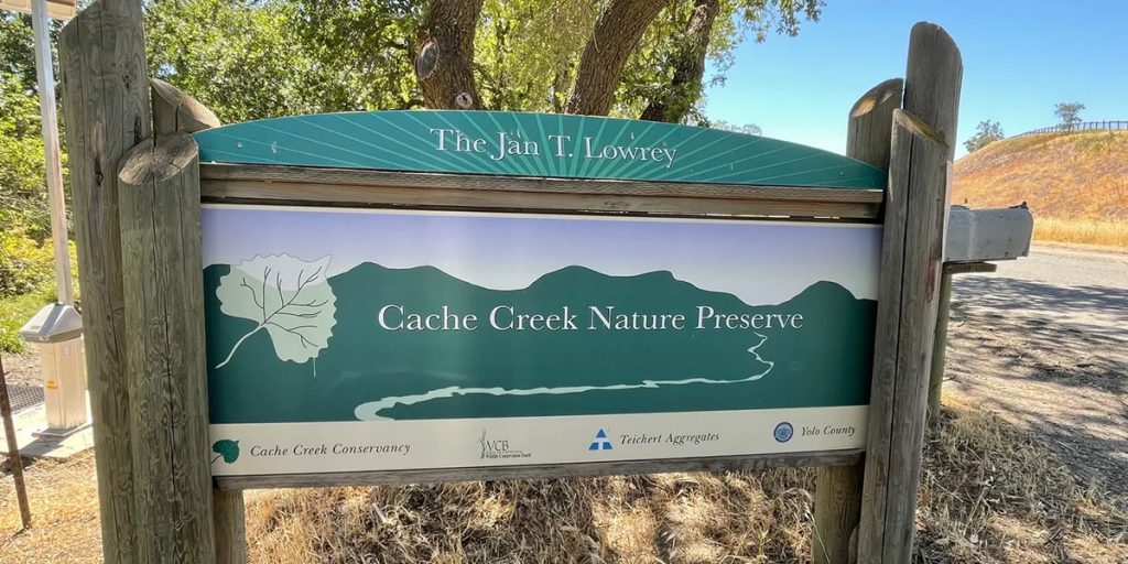
Cache Creek Nature Preserve
34199 County Road 20
Woodland, California 95695
Directions
From Woodland: Take Main St. west. At County Road 98, Main St. turns into Highway 16. Drive 2.7 miles, bear right onto County Road 22. After .9 mile, keep right onto County Road 94B. Drive 1 mile and turn left onto County Road 20. Drive .4 miles and turn left into the Cache Creek Nature Preserve. You’ll find a map on our Contact page.
Challenge
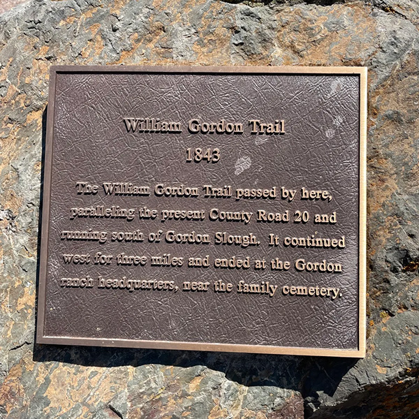
Find the William Gordon Trail Memorial Rock. Follow the driveway into the Nature Preserve and park in the parking lot. To find the William Gordon Trail Memorial Rock, you’ll have to make your way back to the Cache Creek Nature Preserve sign. On the opposite side of the road, there’s a trail that goes along the slough. Follow the trail and you’ll find the William Gordon Memorial Rock.
William Gordon Trail History: This area of Yolo County was an agricultural hub for those passing through during the gold rush. This site marks the spot where a general store was located. Food and other goods could be purchased by those passing through on their way to make their fortunes in gold.
Photo Sites
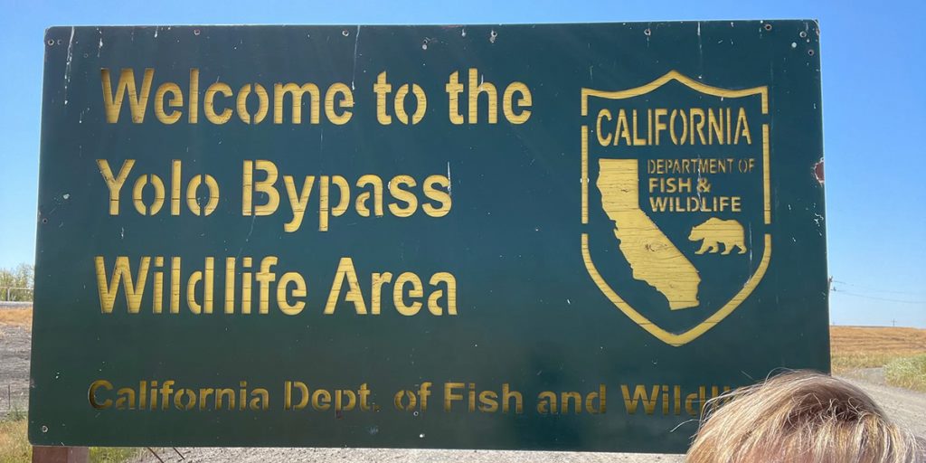
1. Photo in front of the Cache Creek Nature Preserve sign as shown below
or
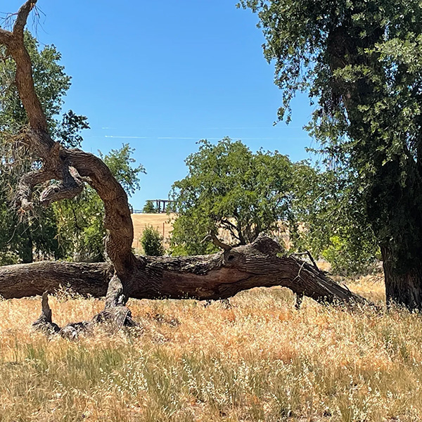
Photo by the large downed tree limb
and
2. Photo by the William Gordon Trail Memorial Rock

Yolo Bypass Wildlife Area
45211 County Road 32B (Chiles Road)
Davis, CA 95618
Directions
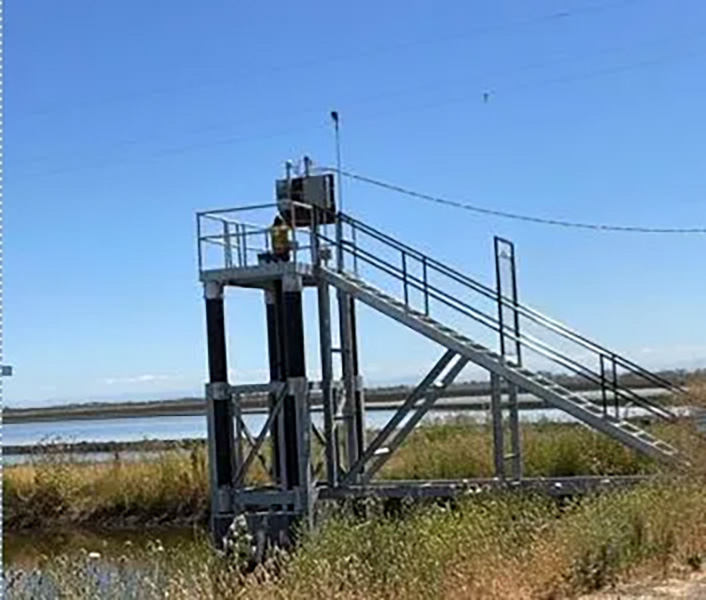
From westbound I-80: From downtown Sacramento take the East Chiles Road exit. Once on the south side of the freeway reset our odometer to zero and take the first gravel road on the left, you’ll see the sign. Drive up and over the levee and into the parking lot. Follow the road immediately to the right upon entering the parking lot. Drive for about a mile keeping right at the staircase (photo below), and park in parking lot B.
From Woodland: Take 113 toward Davis, merge onto East I-80, take East Chiles Road exit, turn right into the Yolo Bypass Wildlife Area, then follow the directions above.
Challenge
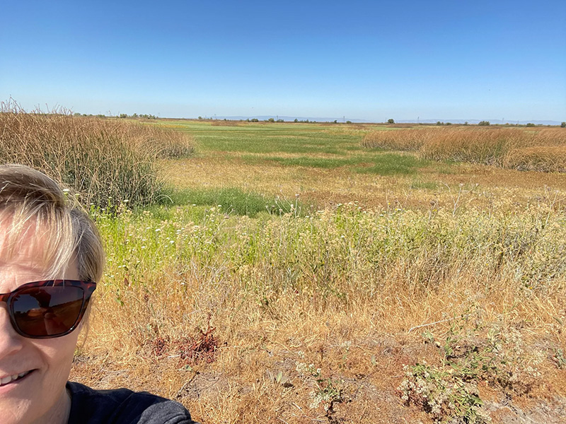
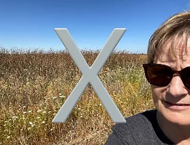
The trailhead is at the east end of the parking lot and will take you along some of the wetland areas. Try to find some of the green grass areas for your photos. Please don’t send photos of the tall tule grass, see examples below.
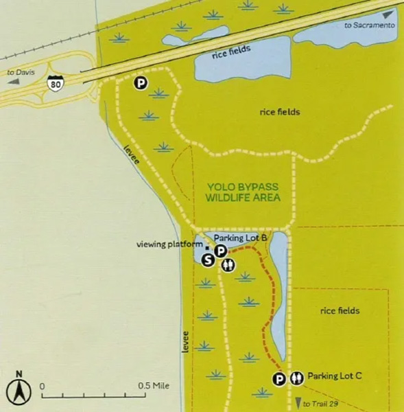
We’ve included a map from the Urban Trails book, the yellow dotted lines are driving roads and the red dotted line is the hiking trail you’re looking for.
Description
The Yolo Bypass Wildlife Area is located in the heart of the Pacific Flyway. These 16,600 acres are a haven for fish, waterfowl, shorebirds, and wading birds, migratory birds, raptors, invertebrates, snakes, turtles, toads, and bats. It is a mix of dry uplands, seasonal marshes, and permanent wetlands with vast flocks of geese in the winter.
Photo Sites
1. Photo in front of the Yolo Bypass Wildlife Area sign as shown above
or
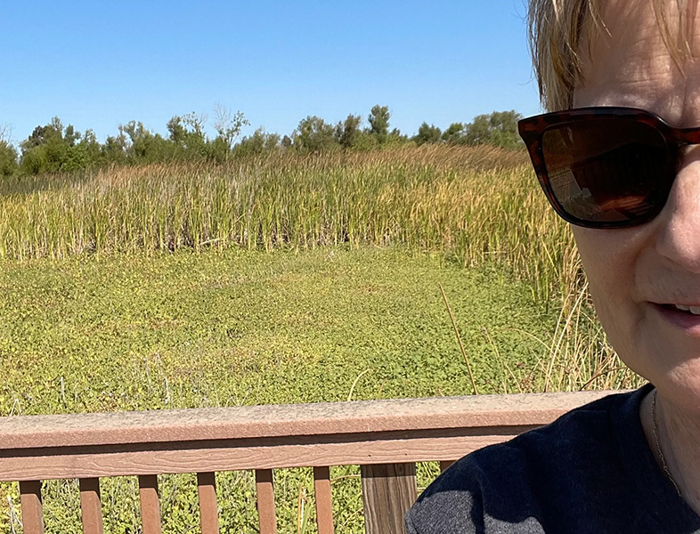
Photo on the viewing platform about 200 feet north of parking lot B
and
2. Photo of a green area along the wetland trail between parking lot B and parking lot C (please, no tule grass)

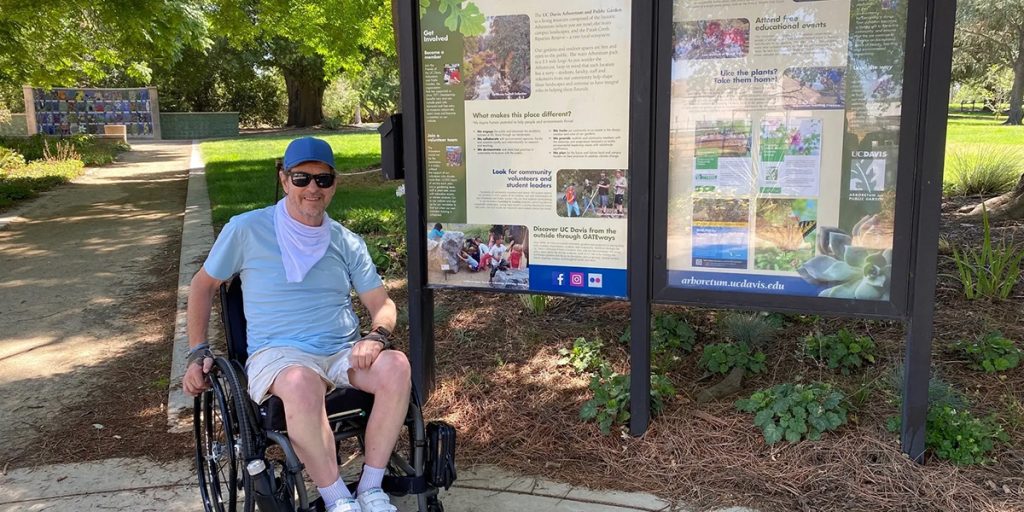
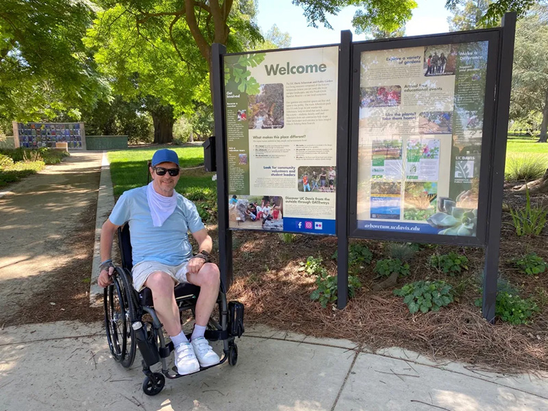
UC Davis Arboretum
1046 Garrod Dr.
Davis, CA 95616
Directions
From Sacramento: Take Richards Blvd exit off I-80. Go .2 mile northwest into downtown Davis then curve left onto First St. Turn left onto Old Davis Rd. Pass parking lot 10 and turn left into parking lot 5.
From Woodland: Drive south on Highway 113 toward Davis, exit onto I-80 East. Take the UC Davis Mondavi Center exit. Turn left on Old Davis Rd., continue .9 mile, then turn right into parking lot 5.
Description
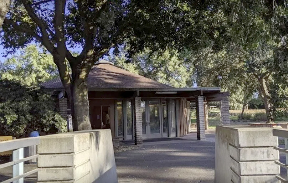
The UC Davis Arboretum hosts a number of plant species and features more than 20 specialty gardens from around the world, not to mention the 3.5-mile trail that circles the old channel of Putah Creek where you’ll see hundreds of trees, shrubs, and flowers. This is a great place to spend a lazy afternoon.
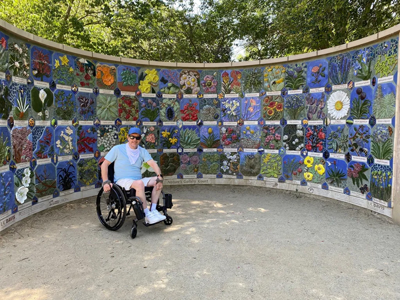
Hike the trail and find the Putah Creek Lodge and the beautiful mosaic wall. Don’t forget to take your selfies.
Photo Sites
1. Photo in front of the Arboretum sign
or
Photo in front of the mosaic wall
and
2. Photo in front of the Putah Creek Lodge
Putah Creek Nature Park
201 Railroad Ave.
Winters, CA 95694
Directions
From Davis: Take Russell Blvd west about 8 miles. cross over US Highway 505 and reach the town of Winters at about 11 miles. Drive .9 mile, turn left on Railroad Ave. Rotary Park parking lot is 4 blocks down on the left. Turn left on Main St. to enter the parking lot.
From Woodland: Drive north on Highway 113 toward Davis about 7.1 miles. Exit right onto Covell Blvd. Continue for about 12 miles. The road will turn into Russell Blvd., cross over US Highway 505 and reach the town of Winters. Turn left on Railroad Ave., Rotary Park parking lot is 4 blocks down on the left. Turn left on Main St. to enter the parking lot.
Description
Putah Creek Nature Park is located behind the Winters Community Center. If you can find the bridge pictured above, you’ve found the park. There is no sign telling you that you made it.
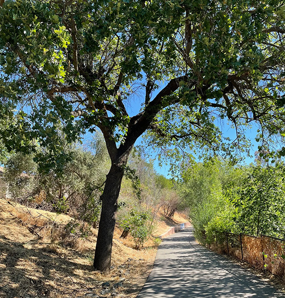
The Putah Creek Nature Park trail has .6 mile of a paved trail that winds along Putah creek before it turns into a dirt path for .2 mile before turning back into a paved trail again. The total length of the trail is 1.0 miles and ends at US 505.
Take some time to explore one of the dirt paths that descends to the creek.
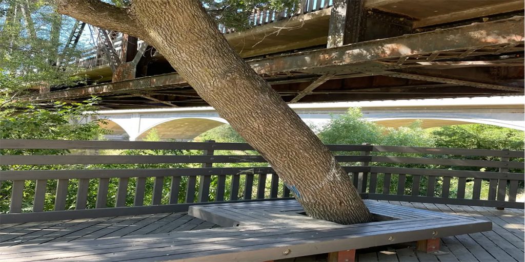
The J. Robert Chapman Memorial Bridge was renovated in 2006 and is a source of pride in Winters. It’s named for a former member of the Winters City Council who was instrumental in its renovation.
Photo Sites
1. Photo in front of the historic bridge
or
Photo below the bridge by the bench and tree
and
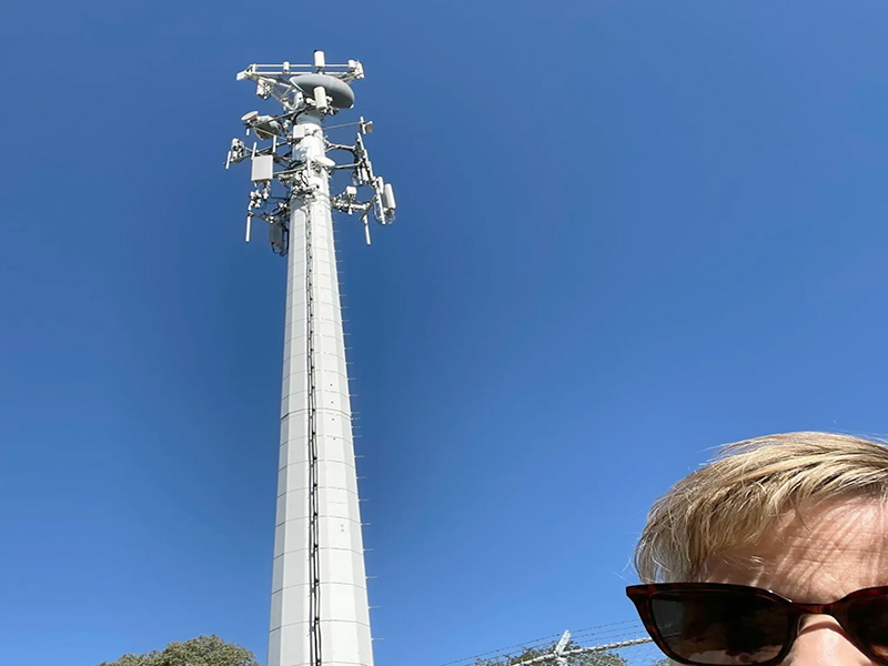
2. Photo in seated on the bench with the cell tower behind you
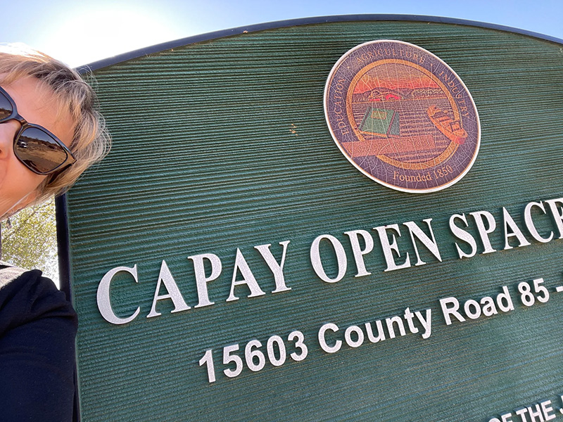
Capay Open Space Park
15603 County Road 85
Capay, CA 95627
Directions
Take State Highway 16 (CA-16) for about 2.76 miles. Turn right onto Yolo Ave/CA-16 for about .46 miles. Turn left onto Woodland Ave/CA-16. Continue to follow CA-16 for about 6.5 miles. Turn right onto County Road 85, proceed to park entrance on the right.
Description
Capay Open Space Park is located off County Road 85, just north of the town of Capay and approximately one-mile northwest of Esparto.
The 41-acre park was donated to the County in 2004 by Granite Construction, and provides direct access to lower Cache Creek. The park contains over two miles of walking trails, a paved parking lot, three shade structures, interpretive panels, picnic tables, restrooms, an ADA access ramp to the creek, and plenty of benches.
Capay Open Space Park contains four major habitat types: bottomland floodplain, riparian woodland, riparian scrub, and oak savanna grassland. A park host resides on the property.
For more information visit our Virtual Tour of Capay Open Space Park.
Photo Sites
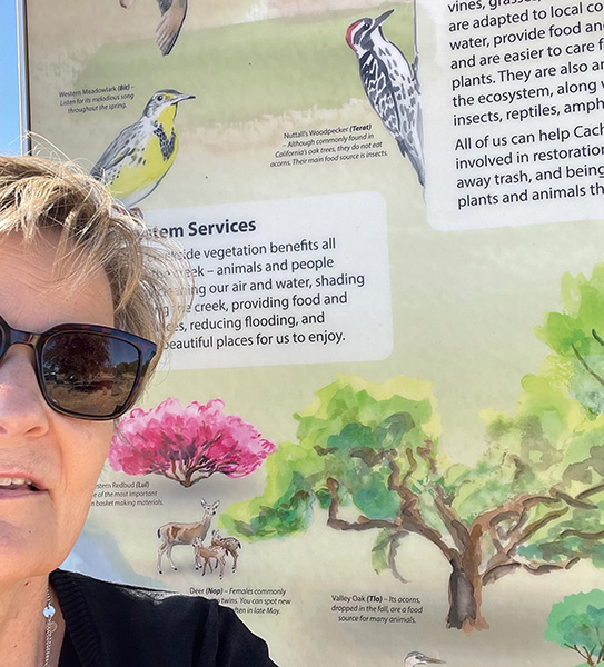
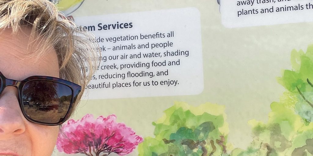
1. Photo in front of any kiosk panel. Kiosk is at the west end of the parking lot.
or
Photo in front of the Capay Open Space Park sign inside the park.
and
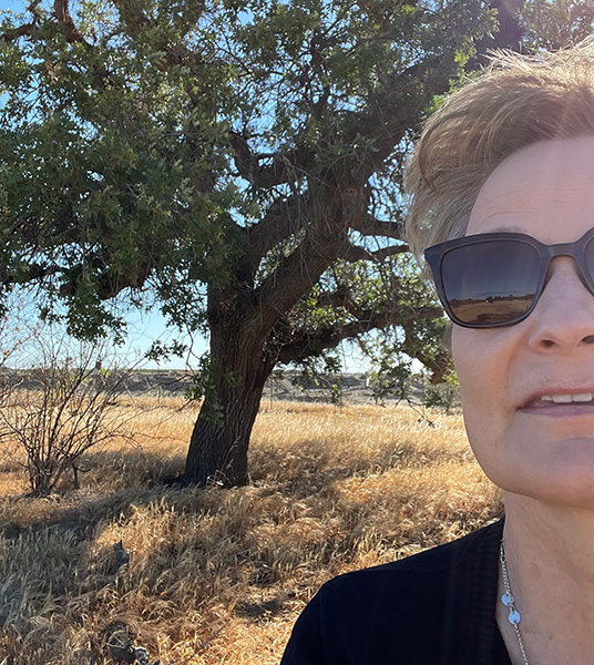
2. Photo in front of the large oak tree at the end of the main trail of the park.