Cache Creek Watershed Stewardship Group
Our Mission
The Cache Creek Watershed Group is dedicated to addressing the complex and interconnected challenges faced by the watershed, including the increasing severity of storms, droughts, and wildfires. Our mission is to sustain and protect the watershed’s diverse values—spanning vital agricultural areas, tourist destinations, natural habitats, and family farms. Through a collaborative, inclusive strategy, we strive to foster cooperative action that supports the watershed’s long-term resilience and sustainability for all its stakeholders.
A Watershed at a Crossroads
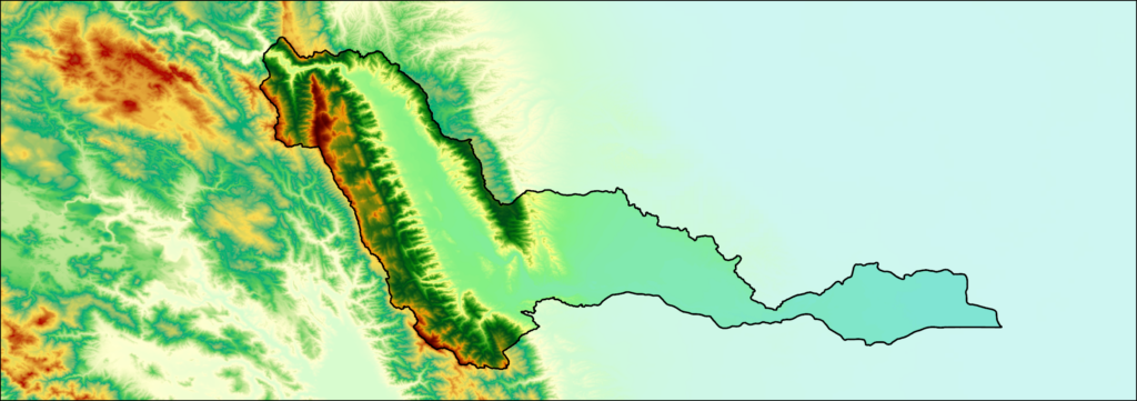
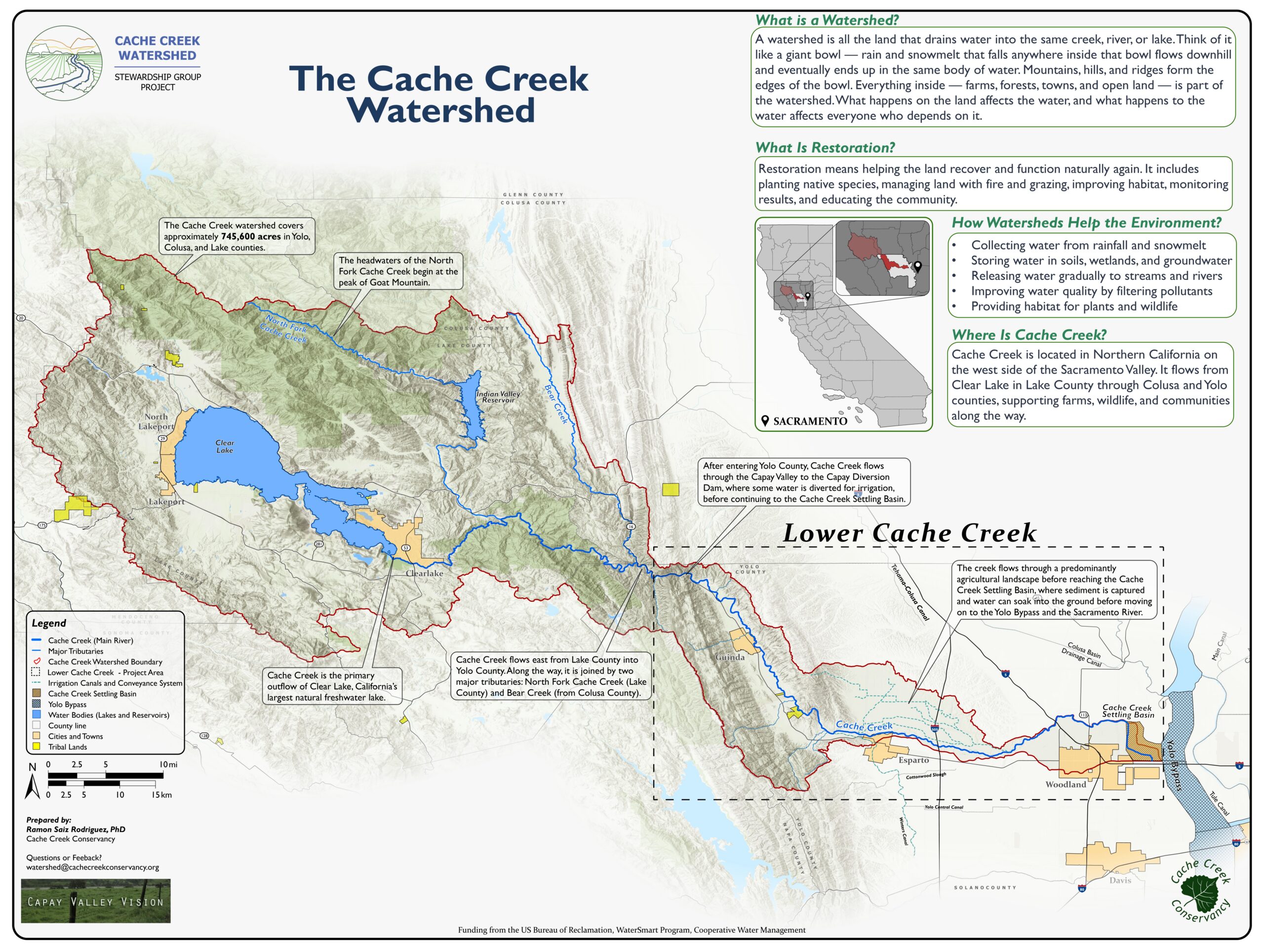
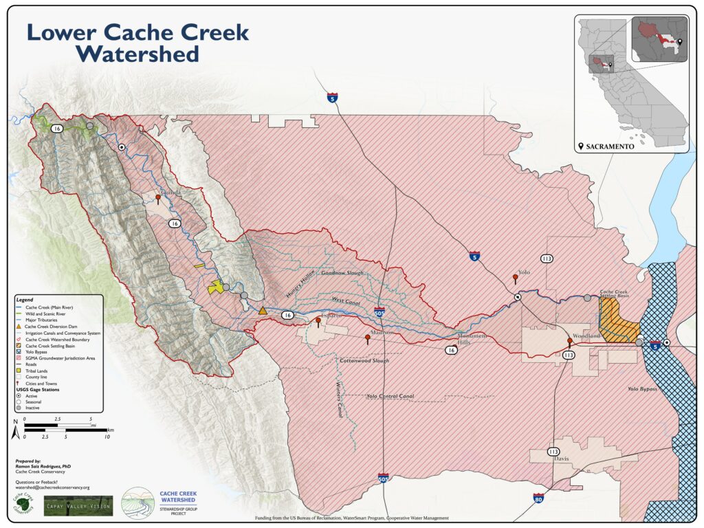
The Cache Creek Watershed is the lifeblood of Yolo, Lake, and Colusa counties. The scope of this project focuses on the Lower Watershed, the majority of which is located in Yolo County, covering an area of approximately 145,000 acres (587 sq km), feeding 150 miles of irrigation canals, and sustaining agriculture, supporting tribal heritage, and providing a natural refuge for wildlife and recreationists alike.

However, the watershed is at a crossroads. Climate change has brought increasingly severe droughts, floods, and wildfires, while groundwater levels continue to decline. Our communities—farmers, ranchers, tribal members, and rural residents—face an urgent, shared challenge.
The Cache Creek Watershed Stewardship Group, led by the Cache Creek Conservancy and the Capay Valley Vision, is building the knowledge base, governance structure, and community trust necessary to chart a sustainable path forward. Together, we will develop a comprehensive Watershed Sustainability Plan by 2028.
This is a civil society-led effort, rooted in the communities that know this land best and depend on it most.
Click Here to Download the Map
Click Here to Download the Map
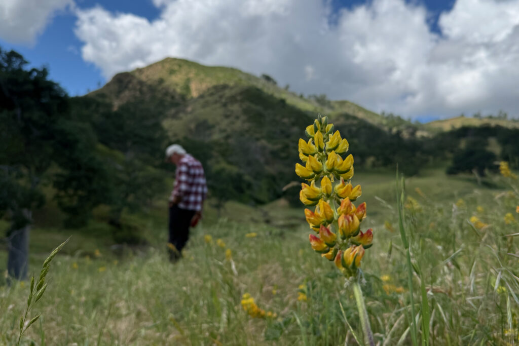
Explore Cache Creek from the ground and from above.
This interactive map lets you explore the watershed through field photos taken across the landscape. Click any pin to see what the creek and its surroundings look like — from the valley floor to the western slopes of the Sacramento Valley.
Photo Credit: Colin H. Richard (colinhrichard.net)
Share your photos with us — email us at [email protected]
Cache Creek Watershed Course
Understanding Cache Creek Watershed
Cache Creek is more than a waterway; it is the lifeblood of the region, connecting the mountains of Lake County to the agricultural heart of Yolo County. Understanding how water moves through this system is essential to making good decisions about its future.
The Cache Creek Water Course: Covers how this system works; where the water comes from, how it flows through the watershed, how surface water and groundwater interact, what drives droughts and dry wells, and what water policies apply in the watershed. Whether you are a landowner, a student, or simply curious about the creek, this course is written for everyone.
The objective of this course is to provide relevant and applied education of water science, policies, and management to residents, farmworkers, businesses, community water advocates, and entry-level professionals in the Lower Cache Creek Watershed — so that anyone who lives, works, or stewards land here can understand, engage with, and shape decisions about our shared water
Visit the [Cache Creek Water Course] webpage
We are actively updating our datasets. The information displayed here is subject to change and should not be considered final.
Monitoring and Community Science Project
Get Involved
There are many ways to be part of this work, no matter where you live or what you do.
News and Updates
April 2026
May 2026
Nov 2025
Contact us
Email:[email protected]